The Magaliesberg Montains
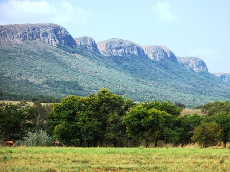
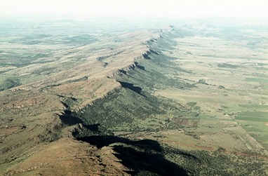
Not many know this, but the Magaliesberg Mountains are among the oldest in the world. They are actually almost 100 times older than Everest. The magnificent stretch of Magaliesberg’s mountains is 120 km long, starting from the Bronkhorstspruit Dam in the east of Pretoria to Rustenburg in the west. They separate the Highveld grassland in the south from the bushveld savannah in the north.
The mountains started to form around 2,300 million years ago when Africa was part of the large mass of land called Gondwanaland and the Transvaal as we know it today was mostly submerged underwater. The salty water that surrounded the area was filled with granite called Auchean Basement Complex. From this granite, fragments of white quartzite, pebbles, sand and silt eroded to gradually form a layer of sedimentary rock over the sea bed.
Cliffs today loom above you, made out of sheer quartzite and overlook the wide valley. The water runoff from the mountains has created deep valleys and gullies over time as well as breath-taking kloofs, with some almost 100m deep. Wedged in amongst the rock are perennial waterfalls of clear, clean water; regular pit stops for hikers.
The Magaliesberg Mountains are one of the best places for hiking and climbing enthusiasts and has been a popular site since the 1920s. The area surrounding the mountains is now an environmentally protected site to preserve its unbridled natural beauty and delicate eco-systems.
The rock solidified over millions of years, forming mainly dolomite and chert rock. Water naturally entered and exited the rock, dissolving some parts of it. This led to natural caves being created, with some becoming reservoirs and becoming the sources of rivers that now flow through the Magaliesberg region. The Skurweberg and Krokodilberg range of hills are found south of the Magaliesberg. These were created when there was more chert than dolomite. The dolomite was transported to the valleys and the chert formed the ridges of these hills.
The Magaliesberg’s intricate geological history is highlighted by what is known as the Bushveld Complex. Around 2000 million years ago, molten magma began to build up deep below the earth’s surface and began to build up pressure. This resulted in a 65000 square km reservoir of liquid rock that infiltrated the sedimentary layers of the Transvaal sequence, which began to crack and subside. The rocks fell into the magma, tilting and jutting out to form jagged mountain ranges around the basin. The magma’s intense heat caused igneous rocks of great mineral wealth to be found around the mountains. This amazing geological phenomenon caused large amounts of manganese, vanadium, chrome, nickel, tin, iron ore and immense platinum quantities to be found.
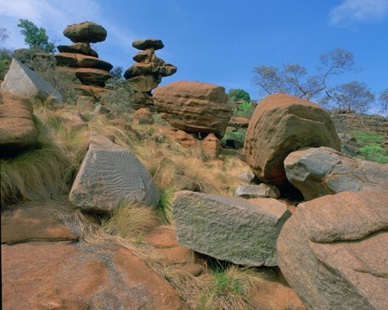
Millions of years meant that the tilted rocks were naturally weathered to form the mountains we see today, the highest being the Magaliesberg Mountains. This awe-inspiring range is one of the best places to stop on the luxury Rovos Hunting Safari.


